We are rebranding!
"Drone Shadow" is becoming Atom Geomatics.
Same team, better technology.
We are rebranding!
"Drone Shadow" is becoming Atom Geomatics.
Same team, better technology.

Atom Geomatics delivers precise, georeferenced maps, orthomosaics and aerial images. We provide reliable data for accurate decision-making and insightful project management for property managers, surveyors, the construction industry and land managers.
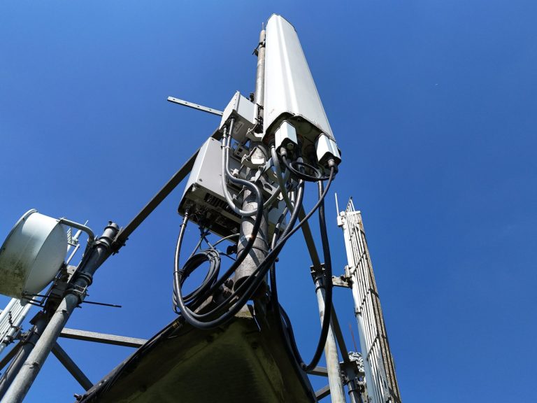
Atom Geomatics drones provide a safe and efficient solution for managing properties and assets, especially in hard-to-access, hazardous, or remote locations. They can quickly capture high-resolution imagery and video of rooftops, facades, industrial equipment, pipelines, and other structures without putting personnel at risk. For remote or difficult-to-reach sites, our drones enable regular inspections, monitor asset conditions, and identify maintenance needs, all while reducing operational costs and improving decision-making with accurate, up to date data.

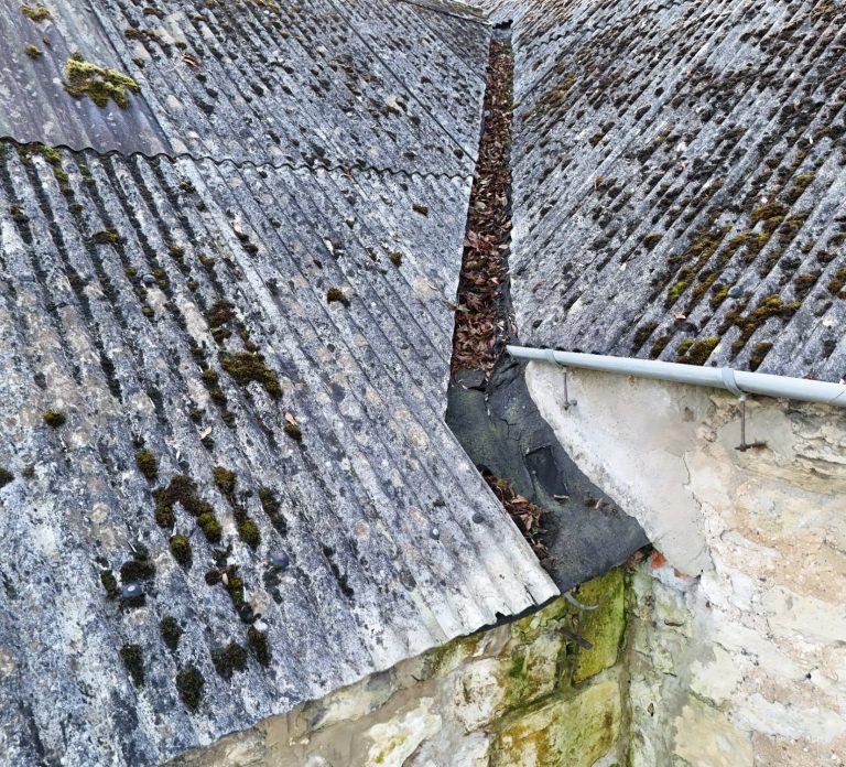
Atom Geomatics drone inspections offer a modern and efficient way to keep asbestos management plans on track.
Instead of incurring the cost of scaffolding or putting people at risk, our drones capture clear images of asbestos roofs from a safe distance. The result is a detailed visual record without anyone needing to get close. It’s faster, safer, and far more convenient, giving you the confidence that your management plan is backed by accurate, up‑to‑date evidence — all without the disruption of traditional inspection methods.
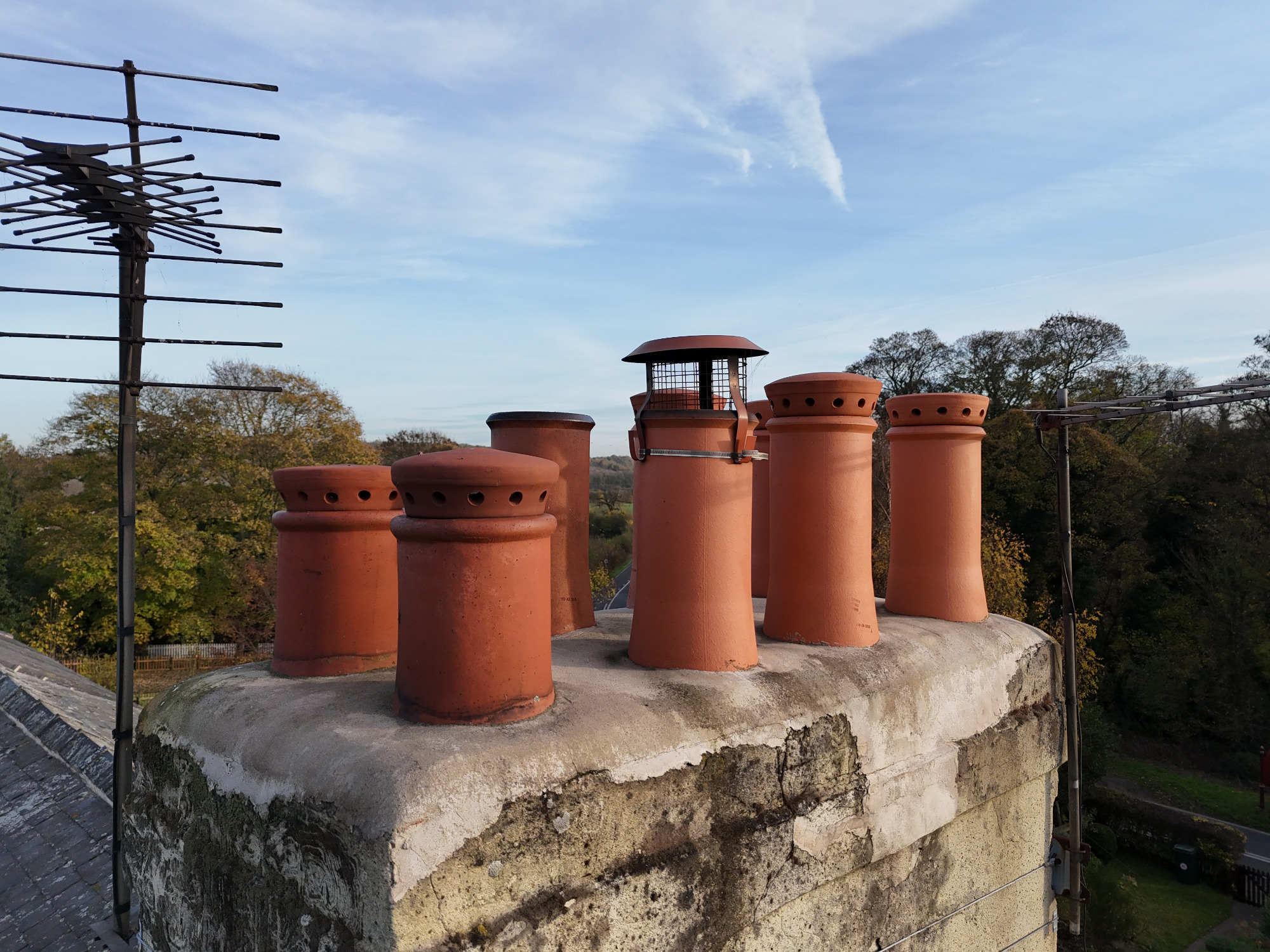
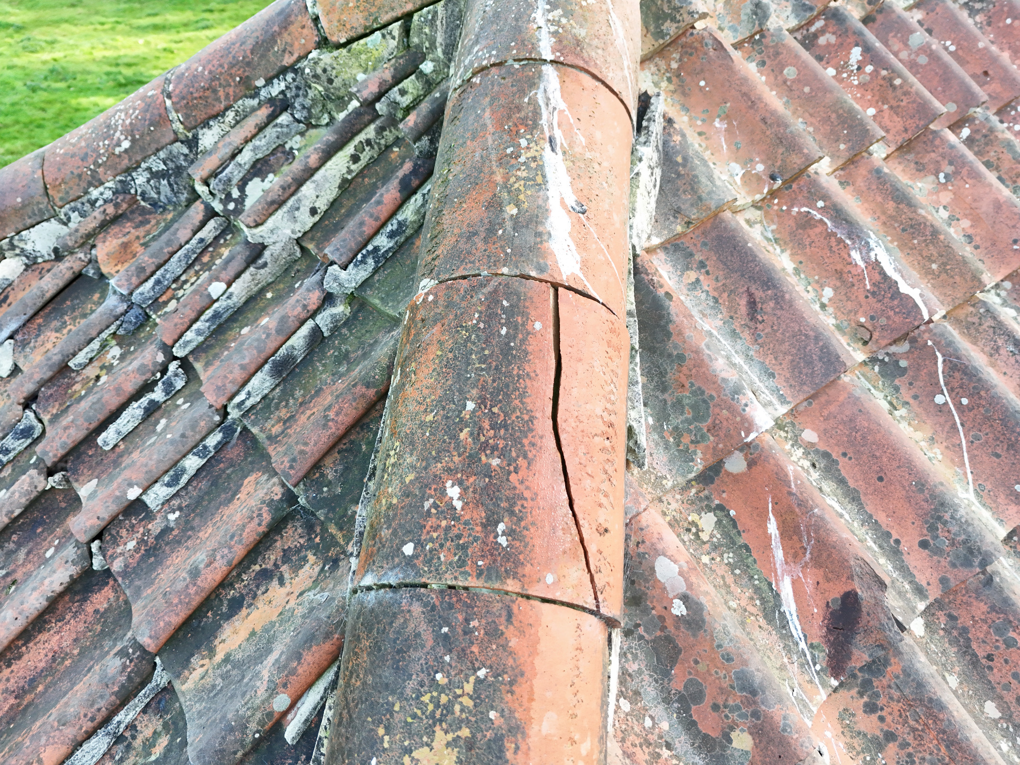
Atom Geomatics drones deliver precise roof inspections by capturing high-resolution imagery to help identify damage, leaks, and structural issues. We make inspections faster, safer, and more efficient, allowing you to reduce risk and make data-driven maintenance decisions—all without ever setting foot on the roof.
We have drones suitable for domestic properties in built up areas as well as large commercial buildings.

Atom Geomatics orthorectified drone surveys provide GIS professionals with accurate, map-true aerial imagery and elevation data for reliable spatial analysis. With survey-grade precision, our surveys streamline data collection, enhance mapping accuracy, and support effective monitoring and decision-making across GIS applications.
Atom Geomatics drone surveys can provide construction teams with highly accurate, map-true aerial imagery and elevation data for monitoring site progress, verifying design compliance, and measuring earthworks. With survey-grade precision, these surveys improve project accuracy, reduce errors, and support efficient, data-driven construction management.
Atom Geomatics orthorectified drone surveys provide civil engineers with highly accurate aerial maps and elevation data, enabling precise site analysis, design verification, and progress monitoring. By delivering survey-grade accuracy and clear visual records, they help reduce errors, improve efficiency, and keep infrastructure projects on track.
Atom Geomatics orthorectified drone surveys give mining and quarrying operations accurate, aerial imagery and elevation data for monitoring stockpiles, pit volumes, and site changes. With survey-grade precision, these surveys enable efficient resource management, track progress, and support safe, data-driven decision-making.
Atom Geomatics orthorectified drone surveys give land managers accurate, map-true imagery and elevation data for monitoring boundaries, vegetation, and land use changes. With survey-grade accuracy, these aerial maps support precise planning, resource management, and long-term land monitoring while reducing errors and improving efficiency.
Atom Geomatics orthorectified drone surveys provide waste management operations with accurate, aerial imagery and elevation data for monitoring landfill sites, tracking material volumes, and assessing site conditions. With survey-grade precision, these surveys improve operational efficiency, support regulatory compliance, and enable data-driven decision-making.
Atom Geomatics orthorectified drone surveys deliver highly accurate, map-true aerial imagery and elevation data for topographical surveys. With survey-grade precision, they enable detailed site mapping, reliable terrain analysis, and efficient monitoring of land features, improving planning, design, and decision-making.


We need your consent to load the translations
We use a third-party service to translate the website content that may collect data about your activity. Please review the details in the privacy policy and accept the service to view the translations.


